Spain

country taxonomy block

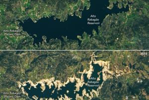
On the Iberian Peninsula Portal and Spain are facing a severe drought, that started in November 2021 and worsened in the following months. Officials in Portugal were forced to limit the use of hydroelectric dams for power production and irrigation, as some reservoirs started reaching significant lows.

The extreme dimension of this event gets revealed on a pair of Landsat 8 OLI (Operational Land Imager) images, operated by NASA and USGS, comparing the state of the Alto Rabagão and Alto Lindoso reservoirs in northern Portugal from March 2021 to February 2022. 

NASA 's earth observatory...

more
Publishing date 21/02/2022

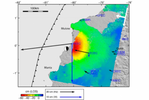
Spanish and Ecuadorian researchers have developed a new methodology to estimate faults and volcanoes that can be activated in a region after an earthquake. The approach consist in evaluating changes of static stress on the surrounding faults and volcanoes and producing maps of potentially activated faults and volcanoes.

The main goal of the study is to achieve an effective transfer of knowledge and scientific techniques to non-expert users who are responsible for the management of disasters and risks.

The study was led by researchers from the European Telecommunications Standards Institute (ETSI) in Topography, Geodesy and Cartography of the Polytechnic University of Madrid (UPM), along with the Complutense (UCM) and the Geological and Mining Institute of Spain (IGME).

These institutions are trying to improve the management of earthquakes and volcanoes through scientific methods using Interferometric Synthetic Aperture Radar...

more
Publishing date 05/11/2018

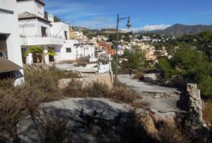
Satellite archives information combined with a new cloud computing platform offer early warning of landslides. An example of this is Carmenes del Mar resort, in the south coast of Spain, that suffered from landslides leaving homes destructed. Combining radar images from various satellites, a team of Spanish researches from the group Analisis del Relieve y Procesos Activos (ARPA) could detect motion of less than a centimeter per year.

Minimal shifts are highlighted in rainbow-like patterns when consecutive radar images of the same site are combined. Traditionally the detection of imperceptible changes was particularly complex requiring a longer period of time. Now it is possible to use new computing services supported by ESA which allow easier and faster use of satellite information.

The online Geohazards Explotation Platform permits the flawless, browsing, access and processing of vast amounts of satellite data. Furthermore there are software tools that extract helpful...

more
Publishing date 29/11/2016

Satellite archives combined with new cloud computing platform offer early warning of landslides. An example of this is Carmenes del Mar resort, in the south coast of Spain. Combining radar images from various satellites, a team of Spanish researches from the group Analisis del Relieve y Procesos Activos (ARPA) could detect motion of less than a centimeter per year.

Minimal shifts are highlighted in rainbow-like patterns when consecutive radar images of the same site are combined. Traditionally the detection of imperceptible changes was particularly complex requiring a longer period of time. Now it is possible to use new computing services supported by ESA which allow easier and faster use of satellite information.

The online Geohazards Explotation Platform permits the flawless, browsing, access and processing of vast amounts of satellite data. Furthermore there are software tools that extract helpful knowledge and share the results.

The benefit of this...

more
Publishing date 29/11/2016

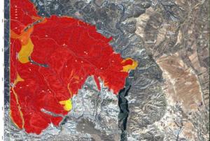
The Copernicus Emergency Management Service was activated by the Spanish Civil Protection Authorities on July 9 after two different fires strongly affected the South of Spain since the beginning of July.

As explained in the Copernicus website, on July 5 a forest fire began in the municipality of Quesada in Jaén province and then spread to neighbouring municipalities. A second forest fire started on July 8 in the area of Lujar in Granada province. The fire reached other municipalities, including Rubite, Gualchos-Castell de Ferro, Órgiva, and Motril.

The Copernicus Emergency Management Service has provided both "Delineation maps" (maps showing the extent of the forest fires) and "Grading maps" (maps showing the damages caused by the forest fires) with the aim of supporting the intervention of Civil Protection Authorities on the field.

more
Publishing date 13/07/2015

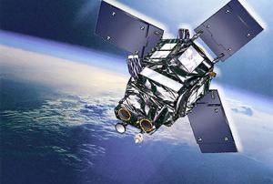
Deimos-2, Spain’s first Very High Resolution Earth Observation satellite launched on the 24th of June 2014, celebrates its first successful year in orbit. It has travelled more than 230 million km and recorded 18,000 images, covering an area of 3.2 million square km.

Its imagery can be applied to several activities, mainly to agricultural and environmental monitoring, water administration and disaster risk reduction and emergency response.

This satellite was developed and owned by the Spanish Elecnor and participates in the European Commissions´ Copernicus Emergency Management Services. Its data is included in the Copernicus data Warehouse and serves to carry out a sub-metric mapping of Europe.


more
Publishing date 25/06/2015

Indra agreed with the European Space Agency (ESA) the definition of the requirements for the system that will manage the Spanish satellite Ingenio. The technological company leads the development, implementation and start-up of the ground segment for the future Spanish ground-based optical observation satellite, which will be ready to enter into service in 2015. With this important milestone, Indra, along with the consortium, firmly undertakes the review of the preliminary design for the second half of the year. Indra has been awarded a contract to lead the project by the Ministry of Industry and became responsible for the integration, installation, testing and start-up of the ground segments for the two satellites in the Spanish National Earth Observation Programme (PNOT): the Ingenio optical satellite and the...

more
Publishing date 28/09/2012

The top award at the Global Mobile Awards, presented in Barcelona yesterday, went to three Japanese operators for their "spirit of collaboration, technological ingenuity and human determination in the face of a disaster of immeasurable proportion".

At the Mobile World Congress in Barcelona yesterday, industry body GSMA named Japanese mobile operators KDDI, NTT DoCoMo and Softbank Mobile as joint recipients of the 2012 GSMA Chairman's Award. The Chairman's Award, established in 1996, is the GSMA's most prestigious award and recognises outstanding contribution to the growth and development of mobile communications around the world. This year's award recognises KDDI, NTT DoCoMo and Softbank Mobile for their efforts in responding to and driving the recovery from last year's devastating magnitude-9.0 earthquake in Japan. "This year we have chosen to recognise not one organisation, but three that together, reflected an astonishing spirit of...

more
Publishing date 29/02/2012

Spain is on track to become the first European country to have a dual Earth observation system, radar and optical, for both civilian and military use. Defense Minister Carme Chacon said radar technology installed on the satellite, which is totally of Spanish design and manufacture, will enable up to 100 images of the Earth's surface to be taken per day at a resolution of up to 1 yard. In three years' time, this capacity will be joined by that of the Ingenio satellite and its optical technology. "With the Paz and Ingenio satellites, our military will have their own observation systems, thus multiplying our autonomy in terms of obtaining information and better protecting the interests of Spain," she said.

Chacon made her remarks at a formal presentation of the Paz satellite this month. The Paz satellite was ordered from Hisdesat by the Ministry of Defense at the end of 2007 under the National Earth Observation Plan to meet the operational requirements of the Spanish...

more
Publishing date 05/07/2011

Global navigation satellite systems (GNSS) technologies are now ubiquitous in everyday life: they are incorporated in electronic devices and are used by the public, surveyors, and geoscientists on a regular basis. In developing countries in particular, GNSS applications offer cost-effective solutions that make it possible to foster economic and social development without neglecting the need to preserve the environment, thus promoting sustainable development.

Current GNSS include the Global Positioning System (GPS), the Global Navigation Satellite System (GLONASS), the BeiDou Navigation Satellite System (BDS) and the European Satellite Navigation System (Galileo). There are also two regional systems, the Navigation with Indian Constellation (NavIC) system and the Quasi-Zenith Satellite System (QZSS), as well as various augmentation systems designed to improve one or more GNSS qualities, such as accuracy, robustness, and signal availability.

In addition to GNSS, other...

more

The aim of this course is to explore the role of remote sensing in monitoring Earth processes and dynamics at a range of spatial and temporal scales, with particular focus on the use of techniques and instruments designed to monitor the global environmental properties of the Earth.

The aims of this course are fulfilled by initially examining the fundamentals and physical basis of remote sensing, and then on how remote sensing is applied to Earth System processes and dynamics. The latest state-of-art techniques to analyse and interpret images will be used to understand local, regional and global environmental changes through worked exercises.

Students will learn the principles of remote sensing systems, and how relevant information can be derived from remotely sensed data over a wide range of spatial and temporal scales and resolutions. Students will also learn about the latest technologies underpinning Earth Observation, and develop image processing ...

more

Uno de los principales objetivos de estas Jornadas es el fortalecimiento de las capacidades a nivel Técnico Municipal para los responsables de la toma de decisiones a nivel local y responsables técnicos de la planificación, desarrollo, gestión de riesgos y coordinación de la respuesta ante potenciales desastres para, conjuntamente, diseñar e implementar planes y programas más efectivos para la reducción de riesgos de desastres, y consecuentemente, para un incremento gradual de la resiliencia en las comunidades que representan. Al mismo tiempo es también uno de los principales objetivos de esta Jornada la transmisión de conocimientos y habilidades para formar nuevos formadores que puedan luego expandir el conocimiento y la información en sus respectivas comunidades para la mejora constante de la Resiliencia en el archipiélago Canario.

The 10-day course will cover all aspects of satellite navigation, up to and including the creation of a satnav-based business.

Hosted by the University of Barcelona at the four-star Hotel Alimara, the Summer School is open to graduate students, PhDs and postdoctoral researchers, as well as young engineers and academics working within industry or agencies, aged 35 or younger.

Internationally renowned scientists and specialists will be giving lectures as well as overseeing practical exercises and lab work.

Participants will receive a full-spectrum overview of satellite navigation, starting from the theoretical basis of the Global Navigation Satellite System (GNSS), its signals, the processing performed by signal receivers and how the position-navigation-time solution is worked out.

Discussion will also be made of threats to satnav systems, such as spoofing or jamming, and the countermeasures...

more

Content

·         Risk, hazard and capacipty maps

·         Vulnerability and capacity assessments

·         Community based disaster risk reduction

·         Early warning systems

·         Natural hazards

more

Contact Person
Ms Pilar Gallego Berruezo
General Director for Civil Protection and Emergencies
Minister of Interior, Spain
Tel: +34 915373300
Email: dgpc [at] procivil.mir.es

Contact Person
Ms Pilar Gallego Berruezo
General Director for Civil Protection and Emergencies
Minister of Interior, Spain
Tel: +34 915373300
Email: dgpc [at] procivil.mir.es