This article is based on a news announcement by the JRC from 11 October 2023: "Drought Risk Atlas: heightened risk threatens the environment and the economy". Find the full article here.
Every year, the City of Bonn celebrates the UN Day with programmes, attractions and exhibits at the Market Square in front of the Old Town Hall, as host city of majority of UN agencies in Germany. This year, the celebration was held on Saturday, 21 October 2023 from 11:00 to 16:00.
Since 2019, the City of Bonn puts a special thematic emphasis on the 17 Sustainable Development Goals and the overall theme is “Leaving no one behind”. This year also celebrated the 50th anniversary of Germany as member of the UN.
This year’s International Day for Disaster Risk Reduction addresses the connection between disasters and inequality. Disasters and inequality are two sides of the same coin. Each adversity reinforces the other: unequal access to services leaves the most vulnerable exposed to the danger of disasters; while the effects of disasters exacerbate inequalities and push the most at risk further into poverty.
On 11 October 2023, high ranking authorities of the Ministry of Emergency Management of the People’s Republic of China, the United Nations Office for Outer Space Affairs and other government agencies in international and regional organizations opened the Sub-Forum on Disaster Prevention, Reduction and Relief in Beijing, China. The Sub-Forum is one of the activities of the Belt and Road Ministerial Forum for International Cooperation in Disaster Risk Reduction and Emergency Management that has been launched by the Government of the People's Republic of China.
This is event is available for participation on an ongoing basis
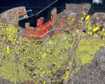
Global navigation satellite systems (GNSS) technologies are now ubiquitous in everyday life: they are incorporated in electronic devices and are used by the public, surveyors, and geoscientists on a regular basis. In developing countries in particular, GNSS applications offer cost-effective solutions that make it possible to foster economic and social development without neglecting the need to preserve the environment, thus promoting sustainable development.
World Space Week is an international celebration of science and technology, and their contribution to the betterment of the human condition. The United Nations General Assembly declared in 1999 that World Space Week will be held each year from October 4-10. These dates commemorate two events:
This is event is available for participation on an ongoing basis
The United Nations Office for Outer Space Affairs, the World Health Organization and the United Nations Conference on Trade and Development are co-organizing, in collaboration with the Government of Switzerland and Space and Global Health Network hosted by the Geneva Digital Hub, the International Conference on Space and Global Health to raise awareness, build capacity and increase collaboration between the space domain and the global health domain, by inviting decision-makers and practitioners from both domains to share their experiences.
This is event is available for participation on an ongoing basis
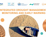
Droughts have deep, widespread, and often underestimated impacts on societies, ecosystems and economies. While drought is a recurring and natural climatic phenomenon, climate change is increasing temperatures and evaporation as well as disrupting rainfall patterns, increasing the frequency, severity and duration of droughts in many regions.
A proactive, integrated approach to drought management is essential. Three pillars need to be considered to ensure a successful drought policy and implementation:
The course is open to participants representing various stakeholder groups working with drought management who are interested in taking the course and completing all modules. This includes:
Meteorological and hydrological experts from climate departments, climate service providers, environmental and disaster risk reduction agencies, agriculture experts and policy-oriented professionals
Stakeholders and professionals forming part of water management, civil society, river basin or international organizations; development programmes and members of UN organizations; and representatives of the private sector
Sustainable Development Goals focal points and facilitators within national governments
Decision-makers, policymakers, resource managers and high-level professionals and managers active in governmental bodies
Capacity developers active in the fields of Drought Management, Integrated Water Resources Management, Climate Action, among others.
Gender balance is very important for all course partners; we especially encourage women to participate in this course.