In Malawi, in order to raise awareness regarding the use of UN-SPIDER recommended practices, more than 490 maps of the standard vegetation index were created in July, covering the period from April 2000 to June 2021. Those maps were created by ZFL. In addition, a map of areas flooded in March 2019 was developed. The maps were presented to the Department of Disaster Management Affairs of Malawi and to the Office of the United Nations Resident Coordinator in Malawi.
In recent years, Southern Africa has been experiencing more frequent and intense droughts that impact rural communities. In order to raise awareness regarding the use of UN-SPIDER recommended practices, more than 490 maps of the standard vegetation index were created for Namibia, covering the period from April 2000 to June 2021. The maps were created by the Centre for Remote Sensing of Land Surfaces (ZFL) of the University of Bonn in its role as a UN-SPIDER regional support office in the period from June to August. In addition, a map of areas flooded in Namibia in April 2020 was developed. The maps were presented to the Acting Director of the National Directorate of Disaster Risk Management of Namibia.
In the period from January to May, UN-SPIDER held several virtual teleconferences with staff of the National Space Research and Development Agency and the National Emergency Management Agency of Nigeria and the Nigerian Hydrological Services Agency to continue discussions on ways to address the challenges posed by floods. As part of those discussions, it was agreed that a national expert meeting would be organized with those institutions. The meeting was held from 13 to 15 April 2021.
UN-SPIDER provided virtual advisory support during March and April to the National Coordinating Agency for Disaster Risk Reduction of Guatemala following the eruption of the Pacaya volcano. As part of that support, the National Space Commission of Argentina, in its role as a UN-SPIDER regional support office, donated satellite imagery from its SAOCOM 1 satellite to contribute to tracking the active lava flows
At the request of the National Emergency Commission, and with the support of the national office of the United Nations Development Programme, UN-SPIDER organized two webinars to train new members of the Geospatial Information Team for Disaster Management of the Dominican Republic on space technologies for disaster management. The Team was established by the Commission in 2012 upon the recommendation of UN-SPIDER and includes professionals and specialists from more than 15 organizations in the Dominican Republic with skills related to geographic information systems and remote sensing. The aim of the Team is to contribute to disaster risk reduction, preparedness and response efforts through the generation of relevant space-based and geospatial information.
More than 20 members of the Geospatial Information Team participated in the two-day virtual training course, which included an introduction to examples of the use of space technologies to map the geographic extent of floods and mudslides and the burn severity of forest fires, as well as procedures for preparing flood and storm surge hazard maps.
The World Meteorological Organization’s (WMO) 150th Anniversary takes place on March 23, 2023. The theme for this year’s day is “The future of weather, climate and water across generations”. This theme highlights past achievements, presents progress and future potential regarding meteorology, from the late 19th century telegraphs and shipping forecasts to supercomputers and space technology.
The Intergovernmental Panel on Climate Change (IPCC) has released the AR6 Synthesis Report, which is a comprehensive assessment of the current state of climate change. The report is based on the analysis of the most recent scientific research from around the world and aims to inform policymakers and the public about the latest developments in climate science.
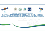
The Space and Upper Atmosphere Research Commission (SUPARCO) of Pakistan, Regional Support Office to UN-SPIDER, is presently undertaking the “Development of Geo-referenced Exposure Database for Catastrophe (NatCat Model)” Project for National Disaster Risk Management Fund (NDRMF). Main components of the project include; floods, droughts, earthquakes and cyclones probabilistic hazard assessment, exposure and vulnerability assessment, financial risk assessment and development of a spatial database and Web Portal.