Drought
Definition
Facts and figures
Further information
UN-SPIDER Regional Support Offices with hazard-specific expertise
Related content on the Knowledge Portal
- Publishing institution:
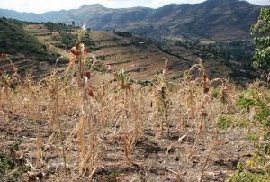
In recent years, droughts have been impacting several regions of the world on a more frequent and severe basis. The long-lasting effects of such droughts are taking a toll on farmers and their livelihoods, forcing some of them to seek alternate sources of income through migration to cities in their countries and in other countries in extreme cases. The World Meteorological Organization identifies droughts as the most damaging natural hazard due to their long-term socio-economic impact. According to the Food and Agriculture Organization of the United Nations (FAO), droughts are the “single greatest culprit of agricultural production loss”.
A drought generally refers to “an extended period of unusually…
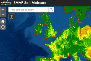
read more22/03/2021Officially launched in 2015 by the National Aeronautics and Space Administration (NASA), the SMAP mission is an orbiting satellite that measures the amount of wetness in the top layer of soil incrementally every 2-3 days. These Soil Moisture Active Passive (SMAP) measurements rely on radiation frequencies that point to different levels of moisture on the surface of earth’s soil and are useful for scientists because it allows them to construct maps indicating the level of soil moisture globally. Acknowledging the relevance and usability of this data for the field of disaster management, NASA recently integrated the SMAP data into its Disasters Mapping Portal.
The Disasters Mapping Portal has been developed by the Geographic Informations Systems (GIS) Team at NASA in an effort to make their satellite…
read more25/11/2020A new report by the world’s largest humanitarian aid network highlights global disasters, populations most vulnerable to them and the efforts of local institutions in preventing, preparing for and responding to them. The 2020 edition of the World Disasters Report, “Come Heat or High Water”, was launched virtually from the offices of the International Federation of Red Cross and Red Crescent Societies (IFRC) in Vienna on November 16. This year’s report discusses climate- and weather-related disasters and their humanitarian impact. It argues for the usefulness of smart financing and space-based information in disaster management support.
The report warns that the global effort to address climate change is leaving behind…
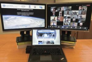
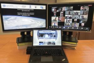
read more19/11/2020In order to discuss and promote the use of space technologies in addressing natural hazards such as forest fires and landslides in Latin America, UN-SPIDER conducted a virtual regional expert meeting on the topic of “Space-based Solutions for Disaster Risk Reduction and Emergency Response in Latin America” from 22 to 24 September 2020. The meeting was jointly organized with UN-SPIDER Regional Support Offices from Argentina (National Space Activities Commission, CONAE), Brazil (Federal University of Santa Maria, UFSM), Colombia (Geographic Institute Agustin Condazzi, IGAC), and Mexico (Mexican Space Agency, AEM).
In Latin America, UN-SPIDER and its Regional Support Offices have regularly carried out regional expert meetings, training courses and other joint efforts since 2011. The last Regional Expert Meeting took place in 2017 in Mexico.
The meeting, which consisted of three two-hour-long sessions, brought together a total of over 200 disaster management stakeholders…
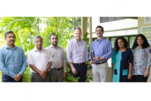
read more28/09/2020The International Water Management Institute (IWMI), a UN-SPIDER Regional Support Office, has won an award for its innovative work using remote sensing technology to help nations monitor and mitigate the impacts of drought. The Institute received the GeoSpatial World Excellence Award 2020 in recognition of the positive impact of its South Asia Drought Monitoring System (SADMS). Since IWMI launched SADMS in 2014, the system has guided national, state and district-level authorities in India and Sri Lanka to take timely action to prepare for drought.
The South Asia Drought Monitoring System (SADMS) provides maps of drought conditions that are produced and maintained at IWMI. Numerous drought indices - including the Integrated Drought Severity Index (IDSI), Standardized Precipitation Index, and Soil Moisture Index - have been developed to provide advanced drought monitoring and assessment information. The system has three components:…read more27/09/2020En décadas recientes muchas comunidades en América Latina y el Caribe han experimentado desastres ocasionados por inundaciones, sequías, deslizamientos, terremotos, erupciones volcánicas y maremotos o tsunamis que han erosionado los logros asociados a procesos de desarrollo. Además, en este año 2020 la pandemia ocasionada por el virus COVID-19 ha impactado a muchos países del mundo, forzando a los gobiernos, al sector privado, a la sociedad civil y a organismos regionales e internacionales a modificar sus planes de trabajo. De manera paralela, varios países del Este de África, del Sudoeste de Asia y de América Latina están experimentando los impactos de la plaga de langosta.
Convencidos que las tecnologías espaciales pueden jugar un papel preponderante en apoyar los esfuerzos que llevan a cabo las instituciones en materia de gestión para la reducción de riesgos, la preparación, la respuesta y la recuperación en caso de desastres; la Asamblea General de las…
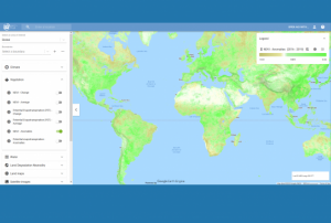
read moreRegional Support Offices mentioned:Google and the Food and Agriculture Organization (FAO) of the United Nations have launched a new tool that provides access to multidimensional maps and statistics showing key climate and environmental trends. Earth Map draws on the processing power of Google Earth Engine and aims to help develop insights based on satellite and FAO’s agriculturally-relevant data alike. It follows the joint development by Google and FAO of the Collect Earth platform for forest and land cover assessments, and integrates with the recently launched FAO Hand-in-Hand geospatial platform.
Tapping into the wide range of multi-temporal and quasi real-time satellite data available through Google Earth Engine, Earth Map provides…
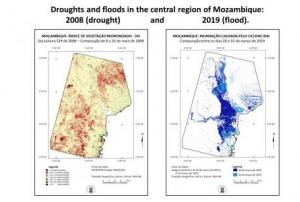
read more18/09/2020The Federal University of Santa Maria of Brazil (UFSM), in its role as a UN-SPIDER Regional Support Office (RSO), and UN-SPIDER joined forces to conduct a virtual seminar on the use of the UN-SPIDER Recommended Practices to process satellite imagery to map the geographic extent of floods, and to elaborate a series of maps that allow government agencies, as well as regional and international organizations, to assess the severity of droughts in particular years in comparison to droughts in other years. The webinar, conducted on 4 August 2020, brought together more than 30 officers of government agencies of Mozambique, as well as researchers, faculty members and students from various universities.
During the event, researchers from UFSM made participants aware of efforts by the space community to develop drought indices extracted from satellite imagery that assess the impacts of drought on vegetation. They also gave participants a brief introduction to the use of…
read more

