News from the community
- 26/09/2018
The Indian Space Research Organisation (ISRO) has launched a new programme to offer educational training in space technology to engineering and science graduates. The application period for the first round of the UNispace Nanosatellite Assembly & Training (UNNATI) will close on 30 September. Further rounds are foreseen in 2019 and 2020.
The selected candidates... Read more
- 26/09/2018
The government of Niger, in partnership with the World Bank and a team of local volunteers, steps up the gathering of data on Niamey’s exposure to floods using drone and open source data to support disaster preparedness.
The initiative started with a team of volunteers, students and young professionals who used an open source mobile application to build a database on exposed people... Read more
- 21/09/2018
A new online SAR tutorial offered by EO College, a joint education initiative for Radar... Read more
- 21/09/2018
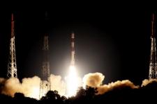
The Indian Space Research Organization (ISRO) launched two Earth observation satellites on 16 September from Sriharikota where the Satish Dhawan Space Center is located. NovaSAR S1-4, which were developed... Read more
- 20/09/2018
The National Emergency Commission (CNE) of the Dominican Republic has launched a National Integrated Information System (SINI) to support decision-making in disaster risk reduction and emergency response. SINI - an inter-institutional, multi-disciplinary geospatial information portal - was developed with the support of the Ministry of the Presidency of the Dominican Republic. The need for such... Read more
- 20/09/2018
“The state of food security and nutrition in the world”, a 2018 global report by the Food and Agriculture Organization of the United Nations(FAO), International Fund for Agricultural Development (IFAD), United Nations Children's Fund (UNICEF), World Food Programme (WFP) and World Health Organization (WHO), highlights the negative... Read more
- 20/09/2018
The Australian Flammability Monitoring System is a new vegetation condition and flammability online mapping tool that is expected to support fire and land managers in Australia.
The mapping tool uses satellite data to collect information on moisture content in highly flammable vegetation such as fallen bark,... Read more
- 19/09/2018
The International Charter “Space and Major Disasters” has been activated on 18 September after Typhoon Manghut hit the northern coast of Luzon in the Philippines with winds of up to 180mph. This has made Manghut one of the strongest storms in decades.
The high winds also churned rough seas as it moved across Luzon, producing 30 feet-high waves, damaging... Read more
- 12/09/2018
China launched a new satellite on 7 September which aims to assist in the forecasting and monitoring of marine disasters.
The HY-1C satellite was put into orbit via a Long March-2C rocket which lifted off from the Taiyuan Satellite Launch Centre in northern China.
The satellite’s overall aim is... Read more
- Publishing organization(s): Federal Geographic Data Committee (FGDC)The Geospatial Platform (GeoPlatform) aims to support the US Administration's–Open Government, Open Data and Digital Government strategies to enhance transparency, collaboration and participation. The GeoPlatform provides a suite of geospatial data, services, and applications for use by Federal agencies—and their State, local, Tribal, and regional partners to meet their mission needs. The GeoPlatform was developed by the member agencies of the FGDC through collaboration with partners and stakeholders. The GeoPlatform is being implemented to help agencies meet their mission needs, including communicating with and publishing data and maps to the public. The GeoPlatform focuses on web applications that facilitate participatory information sharing, interoperability, user‐centered design, and collaboration on the World Wide Web. The GeoPlatform is a key component connecting many goals of the NSDI Strategic Plan in advancing the US National Spatial Data Infrastructure (NSDI). The portfolio of data, applications, and services provided on the GeoPlatform is stewarded through the use of open licenses and careful review and hosted on cloud infrastructure that maximizes geospation interoperability. The GeoPlatform provides streamlined access to National Geospatial Data Assets and reduces data duplication. The collaborative GeoPlatform Marketplace helps reduce data acquisition costs. GeoPlatform's many tools and dashboards support the A-16 Portfolio Management process.
- Publishing organization(s): National Aeronautics and Space Administration (NASA)Hazard type(s):Satellite(s) and sensor(s) used:
- Publishing organization(s): World Resources Institute (WRI)The Global Forest Watch Fires is a dynamic online forest monitoring and fire alert system that provides near real time information to enable people to better combat forest and land fires before they burn out of control.Hazard type(s):Satellite(s) and sensor(s) used:
- Publishing organization(s): Natural Earth
- Publishing organization(s): United Nations Environment Programme (UNEP)Satellite based flood maps
- Publishing organization(s): UNITAR Operational Satellite Applications Programme (UNOSAT), United Nations Office for the Coordination of Humanitarian Affairs (OCHA)Derived products from various satellites processed by agencies in the field of disaster mapping.Hazard type(s):


