China

country taxonomy block

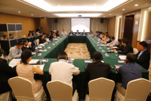
From 2 to 5 June 2015 UN-SPIDER, the National Disaster Reduction Centre of China (NDRCC), and UNESCAP jointly organized the four-day workshop of East Asia Summit (EAS) workshop on ‘Applications of Space Information Technology in Major Natural Disaster Monitoring and Assessment’ and 2nd ASEAN workshop on ‘Development of mechanisms for acquisition and utilisation of space-based information during emergency response. Nearly 50 government representatives and experts from 11 countries, 7 regional and international organizations and 14 research institutes attended the workshop to share experiences on applications of space-based information in major natural disaster monitoring and assessment. Both events took place in Hangzhou, China.

The EAS workshop included sessions on advance remote sensing technologies as well as the service of space based information for space-based disaster risk reduction. A special focus was placed on technology and applications using multi...

more
Publishing date 12/06/2015

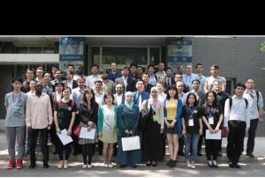
From 20 to 29 April 2015, the UN affiliated Regional Centre for Space Science and Technology Education in Asia and the Pacific (RCSSTEAP), based in Beihang University, Bejijng, organized the ten-day course "Satellite Navigation Technology and Applications". A total of 30 participants from 11 countries participated in the training programme. The aim of the training was to support early career researchers and professionals working on the topics of Global Navigation Satellite Systems (GNSS) and BeiDou technologies.

Invited experts came from France, Croatia, as well as from domestic universities, satellite navigation companies and research institutions. This was the first short course conducted by RSCCTEAP after the centre was inaugurated in November 2014.

Shirish Ravan and Longfei Liu of UN-SPIDER Beijing Office were present in the closing ceremony to interact with the participants and distribute the course certificates. The centre has planned three long-term...

more
Publishing date 04/05/2015

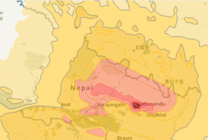
On Saturday, 25 April 2015 a 7.8 magnitude earthquake hit Nepal, India, Bangladesh, and India with several aftershocks following on Saturday and Sunday. GDACS estimates that 6.5 million people are affected. Several actors from the satellite and mapping communities have become active in supporting response efforts in the region; particularly in Nepal, which was most severely affected.

  • Copernicus Emergency Mapping Service (EMS) was activated by EC Services|DG ECHO. Maps are available at the EMS webpage. Regular updates on mapping products are also available via subscription to the Copernicus EMS RSS feed.
  • The International Charter on Space and Major Disasters...
more
Publishing date 27/04/2015

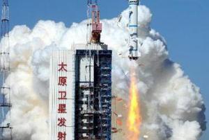
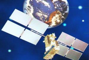
The Chinese BeiDou Navigation Satellite System (BDS) now includes a new-generation satellite, launched into space on Monday, 30 of March.

The 17th BDS satellite has been launched from the Xichang Satellite Launch Centre in the south western Chinese province of Sichuan. The launch marked the beginning of an expansion of the BDS from regional to global coverage.

The satellite will be tasked with testing a new type of navigation signalling and inter-satellite links, providing a basis to start building the global network, according to Business Standard on the basis of Xinhua news agency's report.

The new satellite was developed by the Shanghai Engineering Centre for Microsatellites, a non-profit organisation established by the Chinese Academy of Sciences and the Shanghai municipal government.

more
Publishing date 02/04/2015

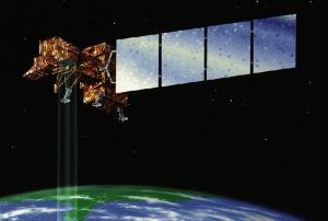
Last Friday, China’s most advanced earth observation satellite, the Gaofen-2, was put into service after being launched in August.

The Gaofen-2 is the second of seven satellites that will be launched for the Gaofen mission, China's high-definition observation project, before 2020. The project was initiated in May 2010 and Gaofen-1 was launched in April 2013.

The new satellite is able to see 0.8-meter-long objects from space in full color and collect multispectral images of objects 3.2 meters or longer, according to the Chinese State Administration of Science, Technology and Industry for National Defense.

The main goal of the Gaofen series is to provide all-weather, 24-hour services covering the globe. The data will be provided for more than ten Chinese government departments as well as for Non-governmental organizations, including private enterprises, in developing value-added services.

more
Publishing date 09/03/2015

More than 50 percent of the most exposed cities in the world for natural disasters are located in Philippines, China, Japan and Bangladesh, according to a recent publication by the global risk analytics company Verisk Maplecroft.

The 5th annual Natural Hazards Risk Atlas (NHRA) shows that of the 100 cities with the greatest exposure to natural hazards, 21 are located in the Philippines, 16 in China, 11 in Japan and 8 in Bangladesh. The combined risk of tropical storms and cyclones, floods, earthquakes, tsunamis and severe storms or extra-tropical cyclones, among others, has placed the small capital city of Port Vila, on the isolated South Pacific island nation of Vanuatu, on top as the world's riskiest ones.

The Philippines is the most exposed country with eight cities among the ten most risky at global level due to a high risk of tropical storms, earthquakes and landslides....

more
Publishing date 09/03/2015

China has announced that its meteorological satellite Fengyun-II 08 has been successfully launched from Xichang Satellite Centre, located in Sichuan Province, South-West China, on 31 December 2014.

The purpose of the satellite will be to collect meteorological, maritime and hydrological data. These data will be used for weather forecasting and environment monitoring.

China has already put in orbit another satellite of the same type, the Fengyun-II 07. It was launched on January 13, 2012, and is today fully operational.

Publishing date 05/01/2015

Chinese and Brazilian officials have announced their intention to deepen their cooperation in satellite development and applications. The space-based collaboration between both nations has already been fruitful in various fields, including remote sensing and Earth observation.

The announcement came as part of a bilateral meeting on space collaboration between both nations held in Beijing, China. During the meeting, images of the jointly developed remote sensing satellite Ziyuan-1-04, as known in China, or CBERS-4, as known in Brazil, were presented.

The satellite carries four cutting-edge cameras, such as the infrared multispectral scanner and wide-field imager and is the fifth of the CBERS satellite series.

The Brazilian minister of science, technology and innovation, Clelio Campolina Diniz, highlighted the multiple benefits the images generated by '...

more
Publishing date 16/12/2014

China has successfully launched its second Disaster Relief Satellite, Yaogan Weixing-24, on Thursday 20 November, at 15:12 local time.

The Yaogan Weixing-24 remote-sensing satellite will carry out disaster relief monitoring, scientific experiments and assess and estimate crop yields.

On 22 October 2014, Yaogan-22 had been launched, the first of the series. Yaogan Weixing satellites use optical and synthetic aperture radar (SAR) sensors.

Publishing date 28/11/2014

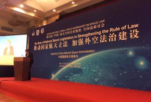
From 17 to 21 November 2014, the United Nations Office for Outer Space Affairs (UNOOSA) jointly with the China National Space Administration (CNSA) and the Asia-Pacific Space Cooperation Organization (APSCO) organised a workshop on space law in Beijing, China. More specifically, the workshop shed light on "the role of national space legislation in strengthening the rule of law".

UN-SPIDER participated in the workshop and Dr. Shirish Ravan of UN-SPIDER Beijing Office chaired the session on “Regulatory and Institutional Aspects on the Use of Space-Derived Data and Information”. He gave a presentation on the topic “The use of space-based information for development and disaster management: Policies and practices”. The presentation was made jointly with Dr. Rokhis Khomarudin of LAPAN (UN-SPIDER Regional Support Office in Indonesia), who specifically highlighted...

more
Publishing date 25/11/2014
Regional Support Offices mentioned:

China will launch about 70 remote sensing satellites to detect the near-Earth space environment and predict extreme events, according to Yang Baohua, deputy general manager of China Aerospace Science and Technology Corporation.

The remote sensing satellites will be part of a broader programme encompassing a total of 120 satellites that are planned to be launched. Of the remaining satellites, about 20 will be communication satellites and 30 navigation satellites.

As stated by Yang, the satellites will help China to meet its increasing demand for aerospace technology and build a self-controlled national space infrastructure that can operate continuously and stably for a long time. Nonetheless, the deputy general manager did not specified when the launches will take place.

Publishing date 11/11/2014

UN-SPIDER participated in the 3rd High Level Forum of the United Nations Committee of Experts on Global Geospatial Information Management (UN-GGIM). The forum took place in Beijing, China, from 22 to 24 October 2014 and focused on "Sustainable Development with Geospatial Information". The event was held in collaboration with the Government of China through its National Administration of Surveying, Mapping and Geoinformation (NASG).

Mr Shirish Ravan, Head of UN-SPIDER Beijing Office, was a panelist in a session on tools and methods for climate change and disaster mitigation. He presented on the topic "Challenges in using Space based Information - Climate Change and Disaster Risk Reduction Perspective".

Bringing all stakeholders together, the Third High Level Forum addressed the role of geospatial information in the post-2015 development agenda, and current critical...

more
Publishing date 27/10/2014

Following a memorandum of understanding of 6 October, the China National Space Administration (CNSA) and the Indonesian Maritime Security Coordinating Board (IMSCB) have signed an agreement on the access to Chinese remote-sensing data.

The negotiated agreement allows the transmission of CNSA remote sensing information to IMSCB ground receiving stations, which are responsible for the Indonesian archipelago's security. The arrangement is intended to improve IMSCB's early-warning capacity and to enhance disaster relief and response and maritime law enforcement.

Chinese remote sensing technologies will deliver valuable data to Indonesia. In particular, space-based information will be useful for maritime surveillance, topography, marine resource management, and environmental monitoring.

more
Publishing date 20/10/2014

China has plans to build a comprehensive earth observation system integrating the use of air-borne, space-based as well as ground-based technologies in the next ten years, the website Economic Times stated, referring to a Chinese top official. This new system would include drones, satellites and GPS systems.

Economic Times reported: "China has already built a network of satellites and other facilities for earth observation in pursuing its space programs including manned space navigation, lunar probe and Beidou GPS navigation system but officials said much remains to be done in the actual application of the technology. The administration will promote the construction of a high-definition earth observation system and the spatial data infrastructure, Xu Dazhe, head of the State Administration of Science, Technology and Industry for National Defence, said."

more
Publishing date 06/10/2014

The UN-SPIDER team warmly welcomes our new colleague in the Bonn Office, Dr. Joachim Post. Joachim joined UN-SPIDER in September and he will be providing technical and scientific support to the Programme. He will mainly support the Bonn Office in its activities, including the further development of the UN-SPIDER Knowledge Portal, Technical Advisory Support, and the establishment of partnerships.

Joachim is a seconded expert from the German Aerospace Center (DLR). He has worked at DLR's German Remote Sensing Data Center (DFD) since 2006 as a research scientist on risk assessment. His work included the development and implementation of tsunami risk assessment and knowledge for early warning in Indonesia (GITEWS project). Additionally, he was involved in several international projects including in Southern and Western Africa, South East Asia, South America and Europe, dealing with applied risk analysis research.

...

more
Publishing date 01/10/2014

The Chinese satellite navigation system Beidou is increasingly used for civilian purposes, as the news agency Xinhua reports, according to Chinese authorities.

Xinhua reported: "In Shenyang, capital of Liaoning Province, there has been surging use of the system in environmental sanitation, logistics and school buses, with the mapping largely used to beef up management efficiency and road safety in the city, according to the local government. It will take a bigger role in government administration, marine fishery and emergency rescues in the future, the government of Shenbei New District said."

The Beidou system is the Chinese version of the American GPS and the Russian GLONASS. Beidou currently only serves the Asia-Pacific region, but the Chinese government plans to create a global system by 2020.

more
Publishing date 01/10/2014

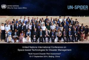
The United Nations International Conference on Space-based Technologies on for Disaster Management - "Multi-hazard Disaster Risk Assessment" took place from 15 to 17 September 2014 in Beijing, China. This Conference was co-organized by the UN-SPIDER Beijing Office of UNOOSA and the Ministry of Civil Affairs of the People’s Republic of China (PRC), in collaboration with the Department of Treaty and Law, Ministry of Foreign Affairs of PRC, the Department of Social Security, the Ministry of Finance of PRC, the Department of System Engineering, China National Space Administration of PRC, the Asia Pacific Space Cooperation Organization (APSCO) and with the support of DigitalGlobe.

More than 110 participants from 36 countries representing 56 organizations attended the event. The conference agenda offered six plenary sessions, three working group sessions and one scientific symposium consisting of about 50 presentations. On the last day, the conference invited...

more
Publishing date 15/09/2014

The Deputy Chief of the Russian Space agency ROSCOSMOS announced that Russia plans to sign an agreement with China this year on the issue of installing GLONASS and Beidou stations in China and Russia, respectively. GLONASS is the Russian satellite navigation system, Beidou is the Chinese navigation system.

On 4 September, "the chief of Roscosmos held a meeting with the head of China’s Satellite Navigation Office Ran Chengqi. The officials discussed Russian-Chinese cooperation on navigation satellite systems GLONASS and Beidou, in particular, the placement of Russian stations in China and Chinese stations in Russia,” the ROSCOSMOS press-service said.

The two sides agreed to establish a sub-commission for cooperation in the sphere of satellite navigation under the bilateral commission in charge of preparing regular meetings of the two countries’ prime ministers.

more
Publishing date 05/09/2014

The International Charter: Space and Major Disasters published its 9th newsletter on 28 July 2014.

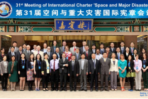
The newsletter announces that the China National Space Administration (CNSA) took over on 17 April 2014 the rotating chairmanship of the International Charter ‘Space and Major Disasters’. CNSA will be leading the Charter for six months, succeeding the Argentinian Space Agency (CONAE). In April 2014, CNSA also hosted the 31st meeting of the Charter, about operational matters and progress and a Project Manager (PM) training course on the International Charter at the China Centre for Resources Satellite Data and Application (CRESDA).

Among the other covered topics: the launch of DAICHI-2 (ALOS-2) from Tanegashima Space Center in Japan, the CNSA contribution of GF-1 Satellite to the Charter and the Universal Access maps provided by Geoscience Australia.

...

more
Publishing date 14/08/2014

On 9 August 2014, the Yaogan XX remote-sensing satellite was launched from the Jiuquan Satellite Launch Center in Jiuquan, northwest China's Gansu Province.

The satellite will be used to conduct scientific experiments, carry out land surveys, monitor crop yields and aid in preventing and reducing natural disasters, the center said.

more
Publishing date 11/08/2014

On 3 August 2014 the International Charter: Space and Major Disasters was activated at the request of the National Disaster Reduction Center of China (NDRCC) in response to a 6.1 magnitude earthquake in the Yunnan Province, South of China. The mechanism will provide space-based maps of the affected area.

Due to this earthquake - the strongest that has affected the Yunnan Province in 40 years - around 400 people have died and thousands have been evacuated. 130 cities have been affected. Ludian and Qiajia County's were among the worst affected, and beyond huge damages from the earthquake, roads have been blocked and communications and power severed in some areas, delaying the transit of vital supplies to survivors. Heavy rain falling over the area is also making rescue efforts more difficult, and storms are expected in Ludian County over the next few days.

Satellite-based products and maps created through the mechanism will be published on the International Charter...

more
Publishing date 04/08/2014

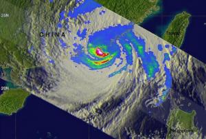
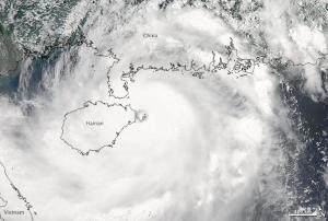
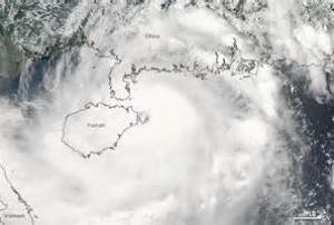
On 18 and 19 July 2014, the International Charter: Space and Major Disasters was activated twice in order to provide satellite-based maps on the impact of Typhoon Rammasun in the Chinese province of Hainan and in Nothern Vietnam.

In Hainan, 46 people have died and an estimated 100,000 people have been evacuated. In Viet Nam, sixteen people have been reported dead and an estimated 27,000 people have been evacuated.

Rammasun Typhoon - which had already devastated the Philippines and passed over southern China - is now dissipated, but another Typhoon, named Matmo, is forecasted to further damage the area.

The satellite products will be published on the International Charter's website as soon as they become available.

more
Publishing date 23/07/2014

After the successful launch of Gaofen-1 in April 2013, China will launch its second high definition optical Earth Observation satellite, Gaofen-2, in the course of 2014, as the State Administration of Science, Technology and Industry for National Defense (SASTIND) announced.

The Gaofen satellite mission will provide support to environmental and climate change monitoring, precision farming, urban planning and disaster management. Gaofen-1 already provided data for several disasters in 2013, including the Lushan earthquake in Sichuan, floods in northeast China and a major earthquake in Pakistan. Gaofen-2 is the second of five or six high definition Earth Observation satellites to be launched as part of the Gaofen satellite series before 2016.

Publishing date 23/07/2014

On 30 June 2014, China and Russia have signed an agreement on the cooperation with regards to navigation satellite systems, as globalpost reported. The memorandum of understanding was signed by the China Satellite Navigation Office and Russian Federal Space Agency on the sidelines of the on-going China-Russia expo in Harbin, China.

According to the news site, Ran Chengqi, director of the China Satellite Navigation Office, said the two countries plan to build monitoring stations in each other's territory, which will promote the integration of the two satellite navigation systems and improve their performance. Russian Deputy Prime Minister Dmitry Rogozin said the two systems can complement each other.

more
Publishing date 02/07/2014

UN-SPIDER participated in the International Seminar on Application of Communication Technology in Disaster Reduction and Prevention organized by the International Civil Defence Organisation (ICDO) in Suzhou, China from 26 to 29 May 2014. UN-SPIDER's expert Ms Longfei Liu gave a lecture on space-based information for disaster assessment and prevention.

19 participants from 16 ICDO member countries and more than 10 international experts attended the seminar. It mainly aimed to enhance the understanding and practical experience of the communication technology for supporting disaster risk reduction. The seminar introduced theories and applications of modern communication through lectures, technical analysis, case studies and simulation exercises focusing on the application of mobile, satellite and...

more
Publishing date 30/05/2014