France

country taxonomy block

The Egyptian Space Agency (EgSA) and France’s Centre National d’Etudes Spatiales (CNES) have signed a space cooperation agreement. The agreement provides a framework for both countries to collaborate on different topics, including satellite developments, exploration of outer space, space applications, R&T, nanosatellites development and training, and the Space Climate Observatory (SCO) initiative, whose mission is to analyze and monitor global climate change and its impacts from Earth observation data. The cooperation will further strengthen the relations between the two countries in the field of space science and technology.

Egypt and France have already collaborated on different fields, including the launch of the NileSat 101 communications satellite, the launch of the TIBA-1 satellite for the...

more
Publishing date 14/04/2020

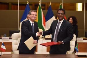
The National Centre for Space Studies (CNES) and the South African National Space Agency (SANSA) have signed an agreement that paths the way for future joint space projects between the two countries. The agreement was signed in the presence of France’s Minister of Europe and Foreign Affairs Jean-Yves Le Drian, and South Africa’s Minister of International Relations and Cooperation, Lindiwe Sisulu.

The agreement targets the following areas of cooperation: space operations, space science, Earth observation, telecommunications, applications, research and technology. The two agencies will also coordinate on international regulatory matters, the Space Climate Observatory (SCO), the International Charter “Space and Major Disasters” and the training of engineers.

...

more
Publishing date 26/04/2019

China and France launched a new joint Earth observation satellite on 29 October which aims to assist with a range of tasks including global marine monitoring, disaster management, and risk reduction as well as tracking the effects of climate change.

The China-France Oceanography Satellite (CFOSat) was put into orbit via a Long March 2C rocket which lifted off from the Jiuquan Satellite Launch Centre in China.

The joint mission between the China National Space Administration (CNSA) and the Centre National d'Etudes Spatiales (CNES), the French space agency, will study ocean surface winds and waves.

The satellite is carrying two radar instruments: SWIM (Surface Waves Investigation and Monitoring), developed by France, which will survey the length, height, and direction of waves; and SCAT (wind SCATterometer), developed by China, which will measure the strength and direction...

more
Publishing date 07/11/2018

Data from the Global Precipitation Measurement mission (GPM), a joint undertaking of NASA and the Japan Aerospace Exploration Agency (JAXA), has helped determine where the largest rainfall leading to the recent floods in France occurred. The data was examined using NASA's Integrated Multi-satellite Retrievals for GPM (IMERG) algorithm and an IMERG-derived map for the Seine River flooding is available online.

While unusually heavy rainfall affected large parts of France in January, the rainfall accumulation map shows that the highest precipitation was observed over the north-east of France and along the Seine River, east of Paris during 17 to 25 January. IMERG data estimates that rainfall totals greater than 180mm occurred along the Seine River.

Other regions in France where the heaviest rainfall occurred...

more
Publishing date 05/02/2018
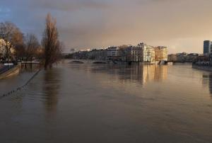
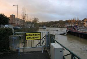
The Copernicus Emergency Management Service has been activated on 23 January due to floods in northern France. Paris and the northeastern part of France are affected as a result of prolonged heavy rains causing a rise of the rivers Seine, Rhine and Ill. Authorities from Meteo France emitted an orange alert for floods. At the moment, 20 departments in northern and eastern France are under orange alert advising citizens to be cautious. While in Paris the Seine river overflowed its banks on Tuesday, only small areas close to the river were affected. French flood risk information system Vigicrues indicated that the maximum level could go up to 6.2 meters during this weekend. Post-event damage assessment maps On 18 and 19 January Germany, Netherlands and Belgium were hit by winter storm Friederike causing several damages on properties, disrupting transportation and leading to power cuts in many areas. In Germany was reported that this storm was one of the strongest... more
Publishing date 26/01/2018
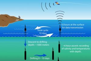
The Array for Real-time Geostrophic Oceanography (ARGO) is an international collaboration effort that has been established to collect temperature and salinity profiles data from the upper ocean to intermediate depths. The ocean data is collected using specially-built autonomous devices, drifting at sea. Since the year 2000, around 800 of these devices are installed each year.
 
While various models of these devices are in operation currently, the data collection proceeds in a similar fashion. After ten days of drifting at various depths, the devices pump fluid into an external bladder as a way to rise to surface. Within the 6 hours of ascent the devices record information on sea salinity and temperature. At the surface, the position of the devices is detected via satellites or GPS and the collected data is transmitted using satellite telecommunications. After the...
more
Publishing date 25/11/2015

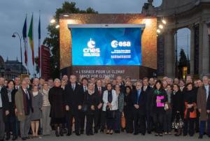
These days, the Champs-Elysées in Paris hosts a Climate Cube presenting information on the contribution of space for studying climate change, right before the upcoming COP21 climate change conference in Paris from 30 November to 11 December 2015.

The Climate Cube presents a high-resolution satellite image of Paris and surroundings, screens display a series of videos on space and climate and other screens give an overview of European satellite missions measuring the ‘essential climate variables’. 

All information demonstrate the importance of satellites and their role in understanding climate change and provide answers on how space is playing a major role in climate research and climate change mitigation.

The Climate Cube is located on the Champs-Élysées, in front of the Grand Palais. The nearest metro station is Champs-Elysées – Clemenceau. The...

more
Publishing date 27/10/2015

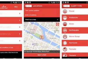
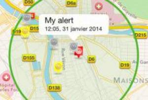
The unit Mediterranean Ecosystems and Risks (EMAX) of the National Institute for Science Research and Technology for Environment and Agriculture (IRSTEA) will start testing the free smartphone app SIGNALERT, developed by the homonym start-up, that allows citizens to report about natural disasters.

The first trials will take place in the South of France to monitor forest fires from July to October. This app will help to enhance early warning, monitoring and management systems for wildfires. A real-time analysis of warning received through the app could allow detecting fires before any other system. SIGNALERT app can be freely downloaded in English and French from AppleStore and Google Play and used by any citizen to report all types of natural events, such as floods and avalanches.

The start-...

more
Publishing date 22/07/2015

At the ongoing Paris Airshow European spacecraft company Airbus Defence and Space announced that they will produce a fleet of 900 satellites for OneWeb, a project carried out by British Channel Islands in order to enable internet access in remote areas. It will be made up of 900 small, low orbit satellites which are cheaper and faster to mass produce and have shorten latency periods than those circling further away from Earth.

The first satellites will be manufactured in the Airbus facilities in Toulouse, but full production will take place in the US. To put the constellation in orbit, Richard Branson’s Virgin Group will likely be involved. Initially only 600 out of 900 will be launched, the rest would be kept as spares.

The expected launch of the OneWeb satellite network is scheduled for 2018 and it will presumably be operational around 2020 and would need hundreds of millions of dollars to maintain in venture. The objective is to connect these satellites to...

more
Publishing date 16/06/2015

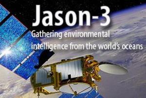
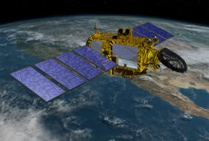
The launch of the Jason 3, a U.S.-French oceanography satellite, has been postponed due to a discovered contamination in one of the spacecraft’s thrusters at its factory in France.

The mission was scheduled to be launched July 22 from California but NOAA announced the slip on Tuesday, June 2, and for the moment officials did not set a new launch date. They are waiting for the outcome of the thruster review taking place at its Thales Alenia Space factory in Cannes, France.

NOAA announced in a statement: “The launch of the Jason 3 mission will not occur July 22, as announced previously. During spacecraft testing, engineers located contamination in one of the four thrusters on the spacecraft. The problem thruster has been replaced. An investigation into the contamination will continue during the next two weeks, as the new thruster is tested.”

Through extend space-based measurements of sea levels and wave height, Jason 3 will be used to monitor...

more
Publishing date 08/06/2015

SIGNALERT is a free smartphone app that enables citizens to report, be aware and manage the experiences with natural or manmade disasters, climate change or pollution at global level. This version makes available the possibility of reporting new phenomena (cyclone, typhoon and hurricane), new advices on what to do during a cyclone and a better interaction with social networks.

A paid version of the app is also available, offering additional services like an emergency “I am Safe” button that sends an SMS to reassure the family and friends of the user while a dangerous situation, providing them the exact location. SIGNALERT is available in English and French and upgrades including a Spanish version and more types of reported phenomenon are being elaborated.

Through the app, users can access real time and structured information about...

more
Publishing date 06/03/2015

The European Commission has awarded a contract worth 12 million Euros to e-GEOS, to provide satellite maps for emergency management. The contract, identified as Copernicus Emergency Management Service – Rapid Mapping, will be active in the period 2015- 2019.

e-GEOS, a company established by Telespazio (80%) and the Italian Space Agency (20%), will lead an international consortium formed by the German subsidiary GAF, the German Aerospace Center (DLR), the Italian company Ithaca and the French partners Sirs and Sertit. Under the new contract, the consortium will prepare and make available to the European Commission, in a short time after the activation of the service by the authorized user, satellite maps of areas affected by a natural disaster or humanitarian crisis.

To facilitate the damage assessment and the assistance intervention management, the European Commission makes available...

more
Publishing date 04/03/2015

On 15 January 2015, the French Space Agency, CNES, made a public statement on its plan to focus on climate science in 2015, in preparation to the major upcoming climate change conference - the 21st yearly session of the Conference of the Parties to the 1992 United Nations Framework Convention on Climate Change (COP 21) - to be held Paris later this year.

CNES President Jean-Yves Le Gall announced that the agency has designated "Space for Climate" as its key theme for 2015, highlighting the role that space-based information plays in monitoring the Earth’s changing climate.

The 2015 plan provides further consistency to the argument that space data is extremely important to monitor our planet's climate, as well as to respond in an effective and timely way to the mounting challenges linked to climate change, such as natural hazards, disaster management and adaptation.

As one...

more
Publishing date 22/01/2015

The main objective of this seminar is to disseminate knowledge and to share expertise and experiences in geospatial sciences on all aspects of natural resource management. This would be a regional seminar mainly for the participants (students/researchers) from Punjab, Haryana, Chandigarh, Delhi, Himachal Pradesh, Uttarakhand and, Jammu & Kashmir. However, participants are welcome from any part of the country. The eminent scientists from premier Remote Sensing Institutes like Indian Institute of Remote Sensing, Dehradun; Space Application Centre, Ahmedabad and National Remote Sensing Centre, Hyderabad will be invited for key note lectures covering various aspects of natural resource management.

Themes: 1. Agriculture, Soil and Water Resource Management 2. Climate Change and Environmental Sciences 3. Land Use, Ecosystems and Forestry 4. Geosciences, Natural Disaster and Hazard 5. Geospatial Planning and Management (including public utility & facility, health, rural and...

more
Publishing date 03/11/2014

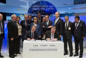
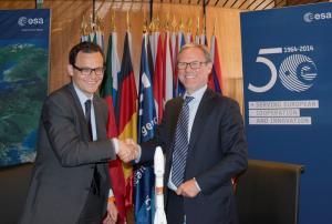
On 16 October 2014, at ESA's headquarters in Paris, France, a contract was signed by ESA and Airbus Defence and Space for creating the second series of MetOp weather forecasting satellites.

These satellites used for climate monitoring and global weather forecasting are a part of MetOp-SG - a cooperative enterprise between ESA and Eumetsat - and will offer augmented continuity to the current main source of global weather data.

MetOp's second generation mission will include six satellites, which can provide diverse but complementary meteorological information. The A series will comprise atmospheric sensors as well as optical and infrared imagers. The B series will be equipped with microwave sensors. Airbus Defence and Space France will work as prime contractor for the A satellites, while Airbus Defence and Space Germany will be in charge of the B series.

more
Publishing date 17/10/2014

Several people have died after torrential rains and subsequent floods in southern France on 17 and 18 September 2014. The International Charter: Space and Major Disasters was activated on 18 September by Direction Générale de la Sécurité Civile et de la Gestion des Crises (COGIC) in order to obtain satellite-based maps of the flood and its impacts. SERTIT will be the Project Manager for this activation.

The International Charter reported: "Rescue workers in the region, including firefighters and police, are working to help the victims and provide support. An orange alert has been issued for more rain on 19 September, however, which weather forecasters predict may bring more floods."

The satellite image products will be published on the International Charter's website as soon as they become available.

more
Publishing date 19/09/2014

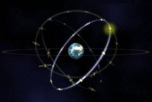
Europe's Galileo satellite navigation system will soon increase: European Space Agency (ESA) announced the coming launch of Galileo SATs 5-6 on 21 August 2014, from Europe's Spaceport in French Guiana.

These two satellites, becoming operative in autumn, will join the four satellites already orbiting: two were launched in October 2011 and two one year later.

ESA and its partner, France's "Centre National d'Etudes Spatiales" (CNES), submitted the satellites to multiple end-to-end system compatibility tests, while the Launch and Early Operations Phase is run from ESA’s Space Operations Centre in Darmstadt, Germany.

Galileo SATs 7-8 are scheduled for the end of 2014, after which the program anticipate launching between 6 to 8 satellites per year.

more
Publishing date 18/08/2014

On 17 July 2014, representatives of ESA and Arianespace met in ESA’s headquarters in Paris to sign a contract to build the Sentinel-1B satellite scheduled. Sentinel-1B is to be launched from the European Space Port in French Guiana in early 2016 to join its sister satellite Sentinal-1A as a dual satellite constellation orbiting Earth 180° apart providing complete coverage of the planet every six days. Sentinel-1B will be a key part of the largest environmental monitoring effort on the planet through ESA’s Copernicus programme.

The Sentinel-1 platform carries out its mission to provide fast response to emergency and disaster situations using advanced radar to scan and monitor the Earth’s surface regardless of time of day or weather conditions.

“With the launch contract now in place, we can now look forward to having both satellites in orbit to complete the mission configuration.” said Prof Liebig ESA Director of Earth Observation...

more
Publishing date 21/07/2014

On 2 July 2014, UN-SPIDER's Senior Programme Coordinator, Mr Luc St-Pierre, participated in the roundtable “Crisis management and mitigation: anticipating, managing and rebuilding” as part of the 2014 Toulouse Space Show.

Apart from UN-SPIDER, the panel included participants from HITEC Luxembourg S.A., PERILS AG, Asian Disaster Reduction Center, DGSCGC, the German Aerospace Center, and MeteoGroup offshore.

The 90 minutes roundtable was facilitated by Science Editor Paul de Brem. It was attended by over 100 persons and allowed to present the work of UN-SPIDER, highlighting UN-SPIDER's two assumptions of work: 1) developing countries have little or no knowledge on how to access and use Earth observation for disaster risk reduction or emergency response; and 2) that Earth observation techniques are better understood and used for emergency response than they are for preparation, mitigation or early warning.

Questions touched on the cost of data,...

more
Publishing date 04/07/2014

The French Space Agency CNES and the US Space Agency NASA have come together in an agreement to conduct the first ever detailed global ocean mapping and surface water survey. The two agencies will be working together in all aspects of the life cycle of a water and ocean surface satellite mission from the design of the spacecraft, its launch and operation during the mission and decommissioning.

CNES and NASA initially began joint studies for the mission in 2009 and the preliminary design phase is scheduled to be completed by 2016 with a launch planned for 2020.

“With this mission, NASA builds on a legacy of Earth science research and our strong relationship with CNES to develop new ways to observe and understand our changing climate and water resources… The knowledge we’ll gain from the Surface Water and Ocean Topography (SWOT) mission will help decision makers better analyze, anticipate, and act to influence events that will affect us and future...

more
Publishing date 07/05/2014

The UN Office for Disaster Risk Reduction invited Paris to join the “Making Cities Resilient” Campaign.

An OECD analysis revealed that the French capital is highly exposed to major flood disasters. The OECD Review on Flood Risk Management of the Seine River commissioned by the French authorities concluded that a flood with the same extent as a historic flood in 1910 could affect up to 5 million people and cause 30 billion Euro losses.

UNISDR Chief, Margareta Wahlström, asserted the importance of flood preparedness and the devastating impacts flood causes worldwide. She welcomed the efforts made in France and the changes that the Campaign has already achieved.

Around 2,000 cities have joined the Making Cities Resilient Campaign and they have built a great network of exchange and learning strategies to strengthen flood risk reduction efforts all...

more
Publishing date 31/01/2014

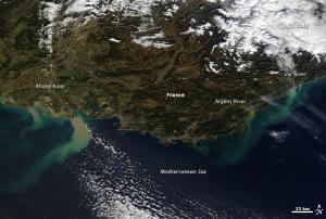
Heavy rainfall caused flooding in southeastern France and northern Italy. On the images taken by the MODIS sensor on NASA’s Terra satellite, the mud-laden runoff is clearly visible creating tan and green plumes of sediment in the Mediterranean.

The floods caused two deaths and forced widespread evacuation. BBC reported on the situation in France: “By Sunday evening, 155 people had been airlifted from the worst-hit areas and the evacuation of residents by boat was continuing.” In Italy, the regions around Bologna, Genoa and Florence experienced widespread flooding, with the city of Modena, in the Emilia-Romagna region, particularly affected.

more
Publishing date 27/01/2014

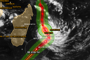
The International Charter Space and Major Disasters was activated to provide satellite imagery products to support emergency response to Tropical Cyclone Bejisa. Bejisa is expected to make landfall on the island La Réunion, one of France's overseas departments in the Indian Ocean. The Charter was activated on 1 January by Direction Générale de la Sécurité Civile et de la Gestion des Crises (COGIC).

Bejisa is the first Tropical Cyclone of this year and was the equivalent of a Category 3 on 2 January evening local time (morning EST) as it brushed the west coast of Réunion. It is expected to cause some minimal property damage and bring a storm surge of 2-4 metres along the coastal areas. According to AccuWeather, high winds and torrential rain have already inundated the island. Saint-Denis, located on the northern part of the island has already been swamped with...

more
Publishing date 02/01/2014

Launched on 7 May 2013, ESA’s Earth Observation satellite Proba-V has now completed the crucial commissioning phase and declared ready for its operational phase, providing global vegetation data for operational and scientific use. Designed to map land cover and vegetation development, the Proba-V miniaturised satellite tracks the entire planet every two days alerting authorities to crop failures, monitoring inland water resources and tracing the steady spread of deserts and deforestation. Proba-V carries a Vegetation instrument that collects light in the blue, red, near-infrared and mid-infrared wavebands, making possible to distinguish between different types of land cover and plant species, including crops.

In an early phase following the launch, the satellite was subject to certain tests to establish contact, confirm its pointing direction and check the various subsystems to ensure their functionality. Afterwards, the Proba-V entered in a commissioning phase that lasted...

more
Publishing date 10/12/2013

With the entering into force of the European Delegated Act on Copernicus data and information policy in the coming days, users will be provided free, full and open access of environmental data from the Copernicus programme, including data from the Sentinel satellites. “The free and open Sentinel data policy will be a breakthrough in the use of satellite data for specialised users, but also for the general public,” said Josef Aschbacher, Head of the ESA Copernicus Space Office.

The first of the Sentinel series of satellites is set for launch next year as part of the European Programme for the establishment of a European capacity for Earth Observation, called Copernicus. It is expected that Copernicus could generate a financial benefit of some €30 billion and a minimum of about 50,000 new jobs by 2030 as well as crucial information to improve the management of the environment, help to understand and mitigate the effects of climate change and ensure civil security.

Publishing date 21/11/2013