Brazil

country taxonomy block

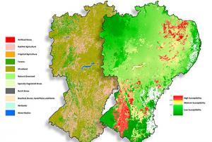
The Federal University of Santa Maria (UFSM) has become the newest member of the network of UN-SPIDER Regional Support Offices, which now consists of 24 institutions around the world. The agreement between the University and the United Nations Office for Outer Space Affairs (UNOOSA) was signed on 27 May 2020 and is valid for three years. UFSM’s main campus is located in the city of Santa Maria, Brazil. The University also operates three additional campuses in the State of Rio Grande do Sul, Brazil.

Since 2014, experts from the University have taken part in UN-SPIDER Technical Advisory Missions to countries in Latin America and developed Recommended Practices that have been published on the UN-SPIDER Knowledge Portal, and have conducted training courses on these and...

more
Publishing date 17/06/2020

The International Charter “Space and Major Disasters” has been activated for floods in Brazil following the collapse of a mining dam. The activation was requested by the Brazilian Disaster and Risk Management National Centre (CENAD). The country’s Ministry of Regional Development is acting as project manager for the activation.

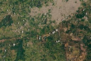
A dam at an iron ore mine in the south-eastern town of Brumadinho collapsed, releasing a torrent of tailings. The large volume of sludge that spilled out of the dam then swept south west to Paraopeba River, burying the site’s cafeteria where workers were eating, as well as nearby homes and vehicles. The mud has reached a depth of 50 ft in some areas. According to media reports, 134 people were killed in the event, while another 199 are still missing.

In...

more
Publishing date 25/01/2019

The International Charter “Space and Major Disasters” has been activated for floods in Brazil by the Brazilian Disaster and Risk Management National Centre (CENAD). The country’s Ministry of National Integration is acting as project manager for the activation.

Mudslides and floods triggered by sudden rain over the western area of the Brazilian state of Rio Grande do Sul have caused the Ibirapuita, Ibicui and Uruguai rivers to break their banks and cause widespread flooding.

The rains have swept away entire neighbourhoods in a mountainous tourist area near RioMetSul Meteorologia reported 497mm of rainfall in 72 hours in the state of Uruguaiana.

Over 2000 people have been displaced and moved to temporary accommodation as the floods damaged houses, blocked roads and water supplies were disrupted.

Local reports say the flooding peak in the city of...

more
Publishing date 14/01/2019

The China-Brazil Earth Resource Satellite-04 (CBERS-04), an Earth observation satellite jointly developed by both countries, was put into operation on Tuesday, July 13, after its launch on December 7. 

Developed by China's Academy of Space Technology and Brazil's National Institution of Space Research, the CBERS-04 can cover areas as big as China in 26 days and will be used to monitor geological disasters and estimate crops, among others. Its predecessor, the CBERS-03 was already launched from Taiyuan Satellite Launch Center on December 9, 2013, but did not reach the proper orbit.

African and Latin American countries will receive the data provided by the China-Brazil Earth Resource Satellite-04 without any charge. 

more
Publishing date 15/07/2015

The International Charter: Space and Major Disasters was activated on 11 June 2015 at 21:37:56 (UTC+02:00) due to major floods in northern Brazil.

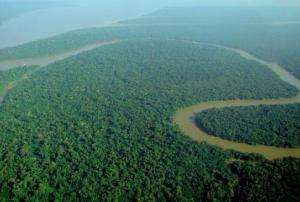
The mechanism was triggered by the Brazilian Disaster and Risk Management National Centre – CENAD, once the situation became unsustainable in the Amazonas state. The Solimoes River, one of the two main branches of the Amazon River in northern Brazil, overflowed in early June as a result of constant heavy rains since April.

Despite the common flooding occurring during this time of the year, this season has brought excessively high water levels that have caused an unusual disaster. This is one of the most extensive floods the country has experienced in recent years, having affected over 250,000 people.

In response to the activation, the Charter will provide up-to-date satellite-based information products and maps to help mitigating the effects of the disaster. 

more
Publishing date 16/06/2015

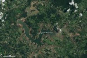
For three years south eastern and eastern Brazil has been experiencing one of its worst droughts in a century and satellite images captured by Landsat-8 in the first months of 2015 do not bring any hope.  

The recent rainy season, from November to March, has not brought any drought relief and the region is already 100 to 200 millimeters (4 to 8 inches) below normal rainfall. One of the biggest reservoir systems, supplying water to half of the people in São Paulo, is only at about 10 percent of its capacity.

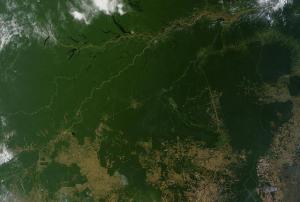
News and advocacy sources have attributed the depleted drinking water supply to a combination of unusual weather conditions and uneven resource management. According to some scientists, deforestation has also played a big role in changing...

more
Publishing date 10/03/2015

Chinese and Brazilian officials have announced their intention to deepen their cooperation in satellite development and applications. The space-based collaboration between both nations has already been fruitful in various fields, including remote sensing and Earth observation.

The announcement came as part of a bilateral meeting on space collaboration between both nations held in Beijing, China. During the meeting, images of the jointly developed remote sensing satellite Ziyuan-1-04, as known in China, or CBERS-4, as known in Brazil, were presented.

The satellite carries four cutting-edge cameras, such as the infrared multispectral scanner and wide-field imager and is the fifth of the CBERS satellite series.

The Brazilian minister of science, technology and innovation, Clelio Campolina Diniz, highlighted the multiple benefits the images generated by '...

more
Publishing date 16/12/2014

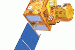
At the sidelines of the Sixth BRICS Summit, India and Brazil signed an agreement on 16 July 2014 which will facilitate Brazilian earth stations to receive and process data from Indian Remote Sensing satellites (IRS), as Geospatial World reported.

In his official statement, India's Prime Minister Narendra Modi laid out the details of the agreement: "This Implementing Arrangement provides for the reception of data from AWiFS and LISS-III payloads of IRS satellites, including but not limited to the Resourcesat-2 at Cuiabá earth station in Brazil on a Government-to-Government cooperation basis."

The implementing agencies of the agreement are the Indian Space Agency (ISRO) and its executive agency (National Remote Sensing Centre) on the Indian side and the National Institute for Space Research...

more
Publishing date 18/07/2014

On 4 July 2014, the International Charter: Space and Major Disasters was activated at the request of the Brazilian Disaster Risk Management National Centre (CENAD) in order to provide satellite-based maps in response to flooding caused by torrential rainfall which had started on 26 June.

Two people have died, an estimated 16,000 people have been evacuated and 150 cities have been affected by the flood events. The state of emergency was declared on 4 July. The same region had already been flooded in mid June. Both events are probably linked to the El Nino phenomena.

The satellite products will be published on the International Charter's website as soon as they become available.

more
Publishing date 08/07/2014

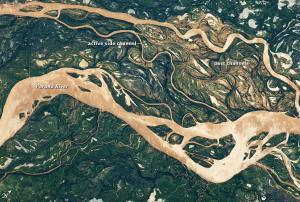
On 14 June 2014 the International Charter: Space and Major Disasters was activated at the request of the Brazilian Disaster Risk Management National Centre (CENAD) in response to flooding and landslides caused by heavy rainfall from 07 and 10 of June 2014 affecting the states of Santa Catarina and Parana.

Due to the flooding and landslides ten people have died and six are still reported as missing, an estimated 40,000 people have been evacuated and 130 cities have been affected. Flooding of the Parana River has impacted not only Brazil but Argentina and Paraguay as well.

Satellite-based products and maps created through the mechanism will be published on the International Charter's website as soon as they become available.

Additionally to the efforts of the International Charter, the crowdsource mapping organization MapAction has deployed volunteers to...

more
Publishing date 17/06/2014

The International Charter: Space and Major Disasters was activated on 21 March 2014 to provide satellite image products in support of the response efforts for floods in the northern regions of Brazil. The mechanism was triggered by the Brazilian Disaster and Risk Management National Centre (CENAD).

The International Charter reported: "Heavy rain in the northern regions of Brazil have resulted in flooding along the Madeira River since February 2014. Thousands of people have been evacuated, and the flooding is gradually growing worse as the water levels rise. A state of emergency was declared in February and 22,000 homes have been evacuated in the area. Many villages along the river were flooded and roads inundated by the flood waters. It is estimated that the affected areas stretch from Porto Velho to Mutum-Parana. No casualties have been reported and this has been attributed to the quick evacuation of the area."

more
Publishing date 24/03/2014

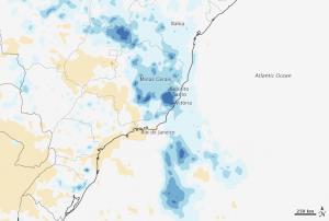
December 2013 was a record rainfall month for many states in Brazil. By December, 27 at least seven cities have set new records for the most rain received during a single month, according to the Brazil’s National Meteorology Institute (INMET). The city of Aimores, in the state of Minas Gerais, received more than 400 percent of the average December rainfall.

Satellite-based measurements of precipitation show the wider patter throughout the states. The image posted by NASA Earth Observatory compares the rainfall observed between 1998 and 2012. The blue areas show rainfall was much more intense in 2013 than average. The measurements were made by the Real-Time TRMM Multi-satellite Precipitation Analysis, which is based on data from the Tropical Rainfall Measuring Mission (TRMM) satellite.

The rainfall in December is extreme but the pattern is similar to other observations made by TRMM in Brazil during the Southern Hemisphere summer. The data collected by the satellite...

more
Publishing date 07/01/2014

Brazil urged Japan to collaborate in the field of disaster prevention using satellite technology. The proposal was put forth by Brazil’s Minister of Science, Technology and Innovation, Marco Antonio Raupp; and Director of Brazilian Space Agency, Himilcon Carvalho; in front of Director of the Japan Aerospace Exploration Agency (JAXA), Hideshi Kozawa. Raupp clarified that Brazil wants Japan's assistance in setting up the National System for Monitoring and Early Warning of Natural Disasters, the Brazilian government is developing and providing the use of satellite images to predict possible storms and phenomena atmospheric.

Raupp added that the starting point for such an agreement may be the International Precipitation Measurement (Global Precipitation Measurement - GPM). This international cooperation programme promoted by the space agencies of Japan and the NASA, is to monitor global rainfall using satellite images of high temporal resolution. Brazil participates in...

more
Publishing date 06/02/2012

As the UN marked World Food Day earlier this week, international representatives convened in Korea to discuss ways to curb the loss of productive land to desertification. Satellites play an important role in the monitoring and assessment of drylands.

Desertification is the degradation of land in arid, semi-arid and dry sub-humid areas. It is caused primarily by human activities and climatic variations because dryland ecosystems are extremely vulnerable to over-exploitation, inappropriate land use and droughts.

This phenomenon has severely affected the livelihoods of farmers around the globe, causing food insecurity in many areas. Satellites have the capability to detect desertification and have seen active land degradation trends even in Europe.

Findings were presented at the 10th Conference of the Parties to the UN Convention to Combat Desertification (UNCCD) in Changwon, Korea.

Held 10–21 October, the event gave representatives an opportunity to...

more
Publishing date 24/10/2011

Brazil — As the state’s largest natural disaster exercise unfolded Tuesday, the response tested the capabilities of emergency responders throughout the Wabash Valley.

“Damage, as they’ve predicted, is widespread, and resources are going to be tight,” Darrel Zeck, public information officer for the All Hazards Incident Management Team, said of the drill.

Zeck participated as part of the command unit for District 7 of the Indiana Department of Homeland Security, which participated in the multi-state exercise to respond to a simulated magnitude 7.7 earthquake on the New Madrid fault line.

“As other countries were impacted down south, it has given us ideas of things that could happen to us as well,” Zeck said. “Hospital overuse. River bridges being down. People stranded out of town.” The mobile command center, a half-million-dollar vehicle equipped with satellite communications capability, was parked...

more
Publishing date 18/05/2011

TerraMA2 is a software product, a computational system, based on the Service Oriented Architecture (SOA), which provides the technological infrastructure required to develop operational systems for environmental risks monitoring and alert. TerraMA2 provides services to gather updated data through internet and to add it to the alert system database; services to manipulate/analyse new data in real time and check if a risk situation exists by comparing with risk maps or a defined model; services to execute/edit/create new risk and alter models; services to create and notify alerts to system users; and other basic and advanced services.

This course will teach you in detail all the steps to build a monitoring system with INPE platform and inform you about several fixes and improvements of the release 4.0.5.

The Conference and Trade Fair for Geomatics and Geospatial Solutions is the largest and most important event of geomatics and geospatial solutions in Latin America. It is proposing a new kind of conceptual experience of interaction between speakers, debaters and participants, using a talk show model, which thereby favoring the exchange of ideas instead of long and unidirectional exhibits.

Another singularity of the event is the way the program was set out, elaborated from intensive surveys in the community sector. This contact is permanent through social networks, visitors to the portal, magazine subscribers and participants of the dozens of events and webinars already organized by MundoGEO.

This year, there are several activities at the event, like informative courses, forums, seminars, workshops, with topics like geospatial solutions for environmental projects, geospatial information for cities management or sensor and earth observation services.

With over 70...

more