We're glad to share with you the April 2019 UN-SPIDER Monthly Updates.
Our latest Data Application of the Month provides background information about why soil erosion is relevant for disaster management and how it can be monitored from space.
Below the updates, you'll also find an events calendar with upcoming conferences, workshops and seminars organized by the community.
Enjoy the read!
UN-SPIDER at a glance
- 30/04/2019
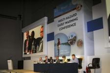
The International Network for Multi-Hazard Early Warning System (IN-MHEWS) is convening the Second Multi-Hazard Early Warning Conference (MHEWC-II) on 13 and 14 May 2019 as a pre-event to the sixth session of the Global Platform for Disaster Risk Reduction (GP2019) in Geneva. The conference aims to highlight the role of… Read more
Country/Region mentioned: - 26/04/2019
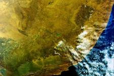
The United Nations Office for Outer Space Affairs, through its UN-SPIDER programme, has activated the International Charter "Space and Major Disasters" on behalf of the National Disaster Management Centre (NDC) of South Africa for the recent floods and mudslides in the country. The German Aerospace Centre (DLR) is acting as project manager for this activation.
Heavy rainfall… Read more
Country/Region mentioned: - 08/04/2019Regional Support Offices involved: Colombia Regional Support Office
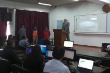
As part of the technical advisory support it provides to countries worldwide in making use of space-based information for disaster management, UN-SPIDER carries out an Institutional Strengthening Mission to Ecuador from 8 to 12 April 2019 upon the request of the Government of Ecuador. This activity is jointly organized by… Read more
Country/Region mentioned: - 01/04/2019Regional Support Offices involved: Argentina Regional Support Office, Colombia Regional Support Office, Mexico Regional Support Office
As part of it advisory support activities, UN-SPIDER is carrying out out a Technical Advisory Mission (TAM) to Peru from 1 to 5 April to evaluate the current and potential use of space-based information in all aspects of disaster management. Based on exchanges with a wide range of stakeholders, UN-SPIDER will provide recommendations as… Read more
Country/Region mentioned:
News from the community
- 26/04/2019
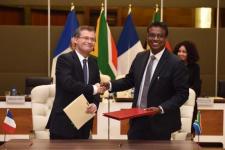
The National Centre for Space Studies (CNES) and the South African National Space Agency (SANSA) have signed an agreement that paths the way for future joint space projects between the two countries. The agreement was signed in the presence of France’s Minister of Europe and Foreign Affairs Jean-Yves Le Drian,… Read more
Country/Region mentioned: - 23/04/2019
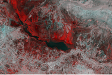
A study conducted by Swiss and Chinese scientists assesses the flood danger posed by glacial lakes across the Tibetan Plateau using an automated satellite survey.
Glacial lake outburst floods (GLOFs) are a major concern throughout the Third Pole Environment, where thousands of glacial lakes have formed and continue to expand in response to climate warming and… Read more
Country/Region mentioned: - 23/04/2019
Optical transmission techniques are considered to be the most effective way to transmit the significant amounts of data obtained day after day from Earth observation satellites to the ground for analysis. With a small test satellite, a corresponding data transmission via laser has now been successfully tested by the German Aerospace Center (DLR) and the University of Stuttgart.
… Read more - 23/04/2019
Sentinel Hub, together with the European Earth Observation programme Copernicus and the European Space Agency, are looking for new and innovative ideas and scripts for Sentinel data processing and visualization. The contest will run until 5 May 2019 and all the entries will be judged by a jury of experts on functionality and… Read more
Satellite(s) and sensor(s) used:Country/Region mentioned: - 19/04/2019
On 3 April, the Sentinel-1A satellite completed five years of activity. Launched in 2014, the satellite works in coordination with Sentinel-1B, launched in 2016. For five years, they have delivered a wealth of data and imagery that are central to Europe’s Copernicus programme.
By offering a set of key information… Read more
Satellite(s) and sensor(s) used: - 15/04/2019
SERVIR, a joint development initiative of National Aeronautics and Space Administration (NASA) and United States Agency for International Development (USAID), and SilvaCarbon, a U.S. government programme working to enhance capacity around the world in monitoring and managing forests, have announced the release of the “… Read more
Country/Region mentioned: - 11/04/2019
An international competition organized by the European Space Agency (ESA) is inviting contributions until 30 June 2019. Copernicus Masters awards prizes to innovative solutions for business and society that use Earth observation data from the European Copernicus programme.
Individuals, universities and… Read more
Satellite(s) and sensor(s) used: - 08/04/2019
After completing in-orbit tests, China officially put two new Earth observation satellites into operation on 21 March. As new part of China’s High-definition Earth Observation Satellite (CHEOS), Gaofen-5 and -6 will aid in environmental protection, agricultural and forestry surveys and disaster relief.
… Read more - 08/04/2019
On 21 March in French Guiana, the Italian remote sensing satellite PRISMA launched aboard a Vega rocket of European launch provider Arianespace. Data from the satellite will be used for natural disaster prevention and disaster response, among other purposes.
The satellite was designed for Italian researchers… Read more
- 04/04/2019
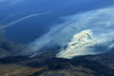
A new review paper presents historical background and current developments for mapping burned area from satellite Earth observation.
The authors explore the physical basis to detect burned area from satellite observations, describes the historical trends of using satellite sensors to monitor burned areas, summarizes the most recent approaches to map burned areas and… Read more
- 04/04/2019
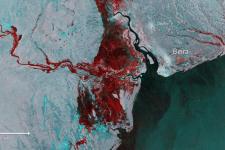
Millions of people in Mozambique, Malawi and Zimbabwe are struggling to cope with the aftermath of Cyclone Idai, which has swept through this part of southeast Africa over the last weeks, leaving devastation in its wake. It is thought that more than two million people in the three countries have been affected, but the extent of… Read more
Satellite(s) and sensor(s) used:Country/Region mentioned: - New satellite-based study of Latin America volcanoes could help researchers better predict eruptions04/04/2019
To predict when a volcano will erupt, researchers rely on indirect signals. However, without long-term and ground-based observations, it is difficult to determine whether these signals are normal disturbances or indicators of a looming eruption. New research suggests satellite data could help to fill that gap and improve scientists understanding of the complex warning signs a volcano… Read more
Country/Region mentioned: - 02/04/2019
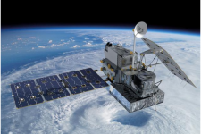
Five years ago, the National Aeronautics and Space Administration (NASA) and the Japan Aerospace Exploration Agency (JAXA) launched the Global Precipitation Measurement (GPM) Core Observatory as a joint satellite. Since then, the instruments on GPM have provided advanced measurements about rain and snow particles within clouds, Earth’s precipitation patterns, extreme weather and… Read more
Satellite(s) and sensor(s) used:Country/Region mentioned:
| Title | Organized by | City | Country | Date |
|---|---|---|---|---|
| Global Platform for Disaster Risk Reduction (GP2025) | United Nations Office for Disaster Risk Reduction (UNDRR) Government of Switzerland |
Geneva | Switzerland | 06/02/2025 to 06/06/2025 |
